The ionosphere is not uniform.
Think of the ionosphere as a three-storey building, each with its own behaviour and specific role in the propagation of your GNSS signals.
Drag
- Winter Anomaly: Why is your GNSS less accurate in winter?
- Winter Anomaly: Why is your GNSS less accurate in winter?
- Winter Anomaly: Why is your GNSS less accurate in winter?
- Winter Anomaly: Why is your GNSS less accurate in winter?
- Winter Anomaly: Why is your GNSS less accurate in winter?
- Winter Anomaly: Why is your GNSS less accurate in winter?
- Winter Anomaly: Why is your GNSS less accurate in winter?
- Winter Anomaly: Why is your GNSS less accurate in winter?
- Winter Anomaly: Why is your GNSS less accurate in winter?
- Winter Anomaly: Why is your GNSS less accurate in winter?
Winter Anomaly: Why is your GNSS less accurate in winter?
Scroll to explore
Winter Anomaly
Why is your GNSS less accurate in winter?
You may have noticed: on some winter days, your GNSS receiver seems less reliable, yet the sun is shining and solar activity is quiet. So where does this mystery come from? The answer lies more than 200 km above our heads, in an invisible but fascinating layer: the ionosphere.
The ionosphere: the invisible guardian of our signals
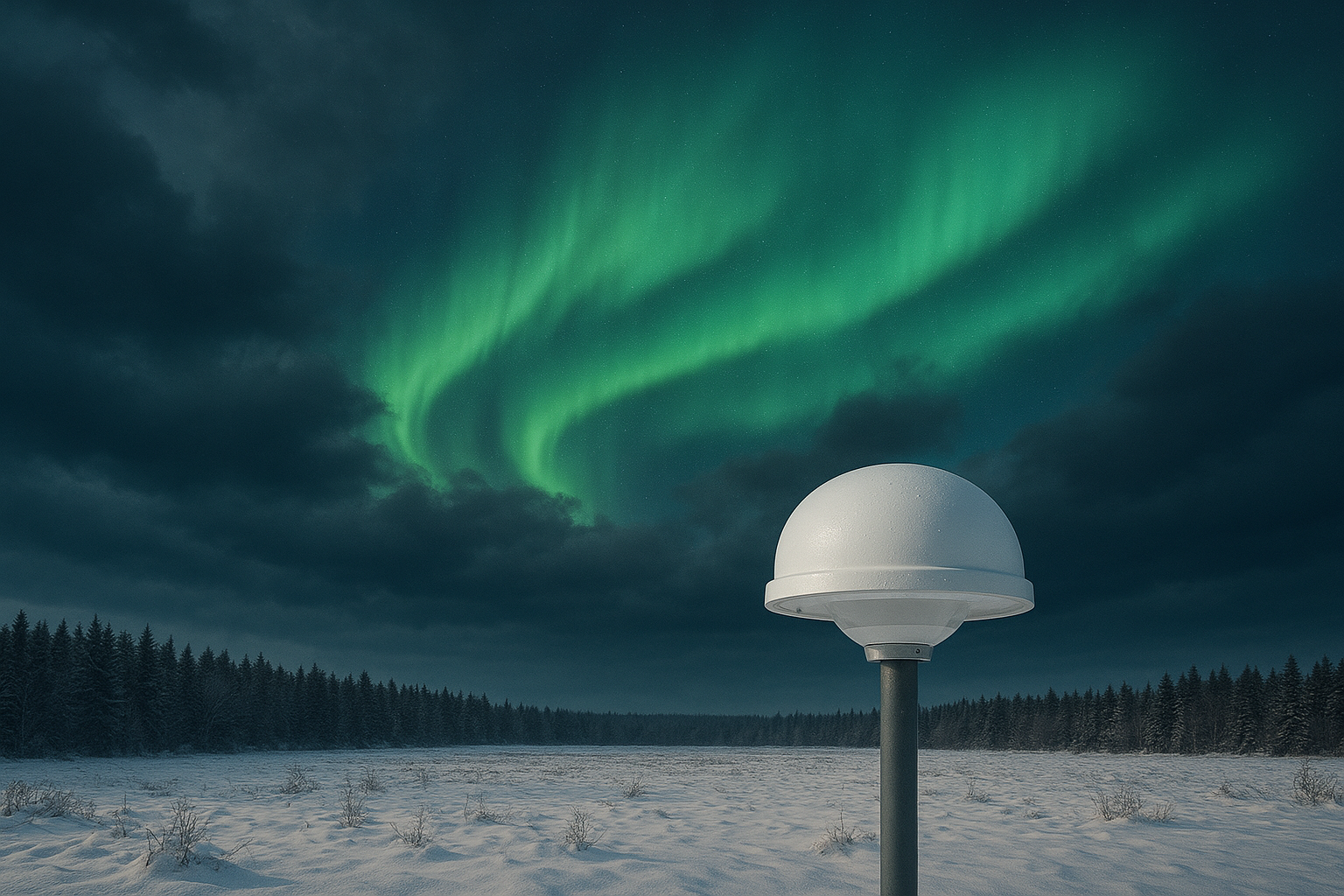
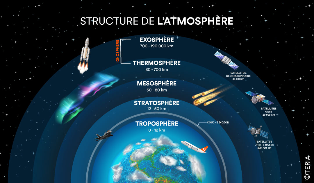
Imagine a huge layer of atmosphere stretching from 60 to 1000 km above the Earth’s surface. This is the ionosphere, an area where the sun’s rays are so powerful that they literally rip electrons from atoms, creating an electric plasma.
This layer plays a crucial role in our satellite positioning systems.
But here’s the problem: GNSS signals passing through this zone are disrupted by these charged particles.
Like light that distorts as it passes through water, satellite signals are slowed down and deflected, creating positioning errors.
Did you know?
The ionosphere is made up of three distinct layers, each with its own characteristics.
The 3 stages of the ionosphere
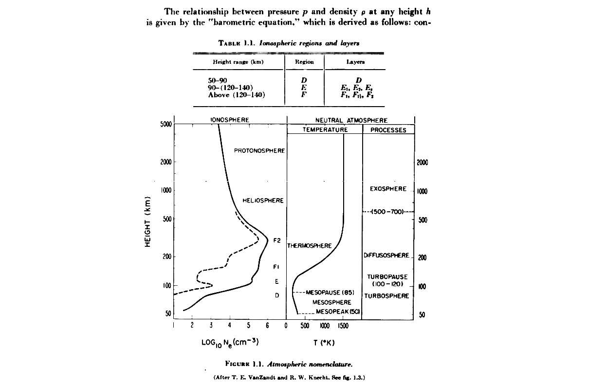
The D Layer (50-90 km)
The discrete stage
The lowest of the three layers, it has little impact on GNSS signals operating at higher frequencies (L-band). Its electron density is low, and during the day, under the effect of solar X-rays, it contributes slightly to atmospheric absorption. But here’s the fascinating part: at night, it almost disappears! Without the constant bombardment of solar rays, the electrons quickly recombine with the ions, and the D layer fades away until the next sunrise. For GNSS, this is the layer of least concern.
The E layer (90-150 km)
The transition zone
Located in the middle, this layer is the scene of constant ionising activity thanks to the sun’s UV and X-rays. Its electron density is moderate and is beginning to have a measurable impact on GNSS signals, albeit limited. An interesting phenomenon occurs here: the sporadic E layer, pockets of intense and unpredictable ionisation that appear suddenly, often caused by high-altitude winds or meteor showers. These events can cause occasional disruption to GNSS positioning. At night, although its ionisation decreases, it never completely disappears thanks to the influence of cosmic rays.
The F layer (150-1000 km)
The keystone for GNSS
This is where the fate of your GNSS signals hangs in the balance! The F layer is the thickest and most ionised of the three. It contains the highest concentration of free electrons in the entire ionosphere. During the day, it is divided into two distinct sub-layers:
– F1 (150-200 km): The lower layer, which appears only during the day. It makes a moderate contribution to GNSS ionospheric disturbances.
– F2 (200-1000 km): This is the highest layer and the densest in electrons. It persists day and night (unlike F1, which disappears after sunset). The F2 layer contains up to 10 times more electrons than the other layers. This is why it has the greatest influence on the speed of propagation of GNSS signals.
It is in the F2 layer, the uppermost layer, that the main story for GNSS is played out. And that’s where the winter anomaly comes in.
When a GNSS signal travels from a satellite to your receiver on the ground, it passes through the entire ionosphere. But it spends most of its time in the F2 layer, which is the thickest. The more electrons there are, the more the signal is slowed down and deflected. The F2 layer contains electron densities that can reach several million electrons per cubic centimetre during periods of intense solar activity. This slowdown results in a delay in the propagation time of the signal, which distorts the calculation of the distance between the satellite and your receiver.
The result: a positioning error of up to several metres without correction!
The Winter Anomaly: When winter takes you by surprise
The key to this strange phenomenon lies in the chemical composition of the atmosphere and its movements:
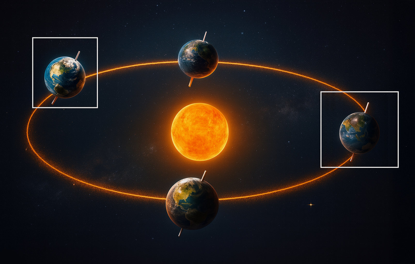
- In summer: The atmosphere expands with the heat. More nitrogen (N₂) rises to higher altitudes. Now, nitrogen is an “electron killer”: it encourages their recombination, thus reducing their lifespan in the ionosphere.
- Winter: The atmosphere contracts. The F2 layer descends into regions where there is less nitrogen. As a result, electrons survive longer, even though less of them are created.
The oxygen/nitrogen ratio (O/N₂) therefore becomes crucial. The more oxygen there is in relation to nitrogen, the more electrons persist. And in winter, this ratio is favourable.
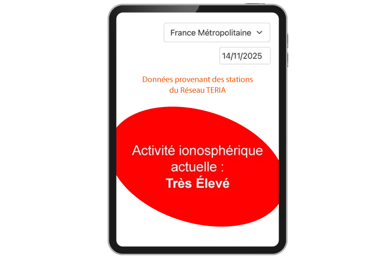
“Warning: The winter anomaly is particularly intense in years of solar maximum, such as 2024 and 2025. Geomagnetic storms amplify the phenomenon even more”

What does this mean for you?
More electron density in the ionosphere = more interference on GNSS signals = potentially greater positioning errors.
It’s mathematical!
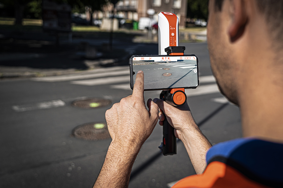
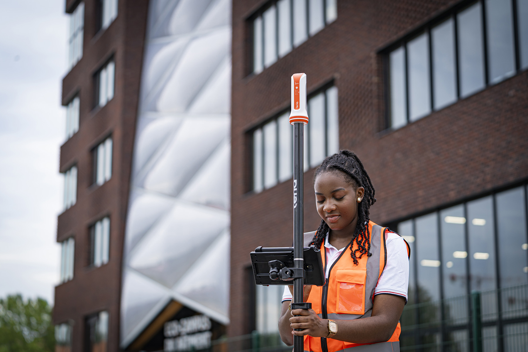
But don’t panic! At TERIA, we have thoroughly tested this phenomenon with our PYX receiver and our network of reference stations.
Our tests: summer vs. winter 2025
We compared ionospheric activity between the summer and winter of 2025, at the height of the solar maximum. Our NRTK (Network Real-Time Kinematic) network played a dual role:
- Analysing ionospheric disturbances in real time
- Provide instant corrections to the PYX receiver to compensate for these disturbances
/ 02
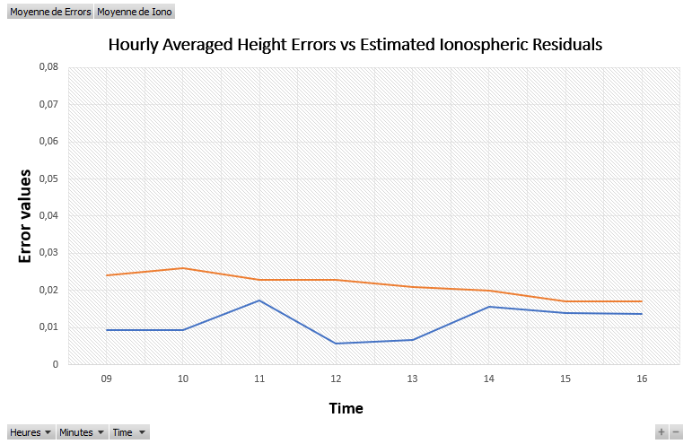
Figure 1: In summer (25 August 2025), ionospheric disturbances (orange curve) and height errors (blue curve) remain low. Ideal conditions for GNSS precision.
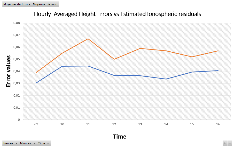
Figure 2: In winter (7 February 2025), ionospheric activity explodes! The estimated ionospheric residuals (orange curve) are much higher, and the height errors (blue curve) increase accordingly. The winter anomaly is clearly visible.
TERIA ‘s response
Here’s the good news: even in the most difficult winter conditions, with the anomaly at its worst, our correction system kept positioning errors below 5 cm!
How did it do this? Thanks to three key elements:
- A dense and robust network of reference stations that continuously monitor the ionosphere
- Data Qualification, our intelligent servers use different algorithms to estimate ionospheric disturbances, using a pessimistic approach (slightly overestimating the impact to guarantee stability).
- Real-time corrections transmitted instantly to the PYX receiver and TERIA users
Result: you benefit from stable centimetric accuracy, whatever the season.
✅ In all our tests, the blue curve (real errors) remains below the orange curve (pessimistic estimate).
This confirms that our system protects you effectively, even in worst-case scenarios thanks to Data Qualification.
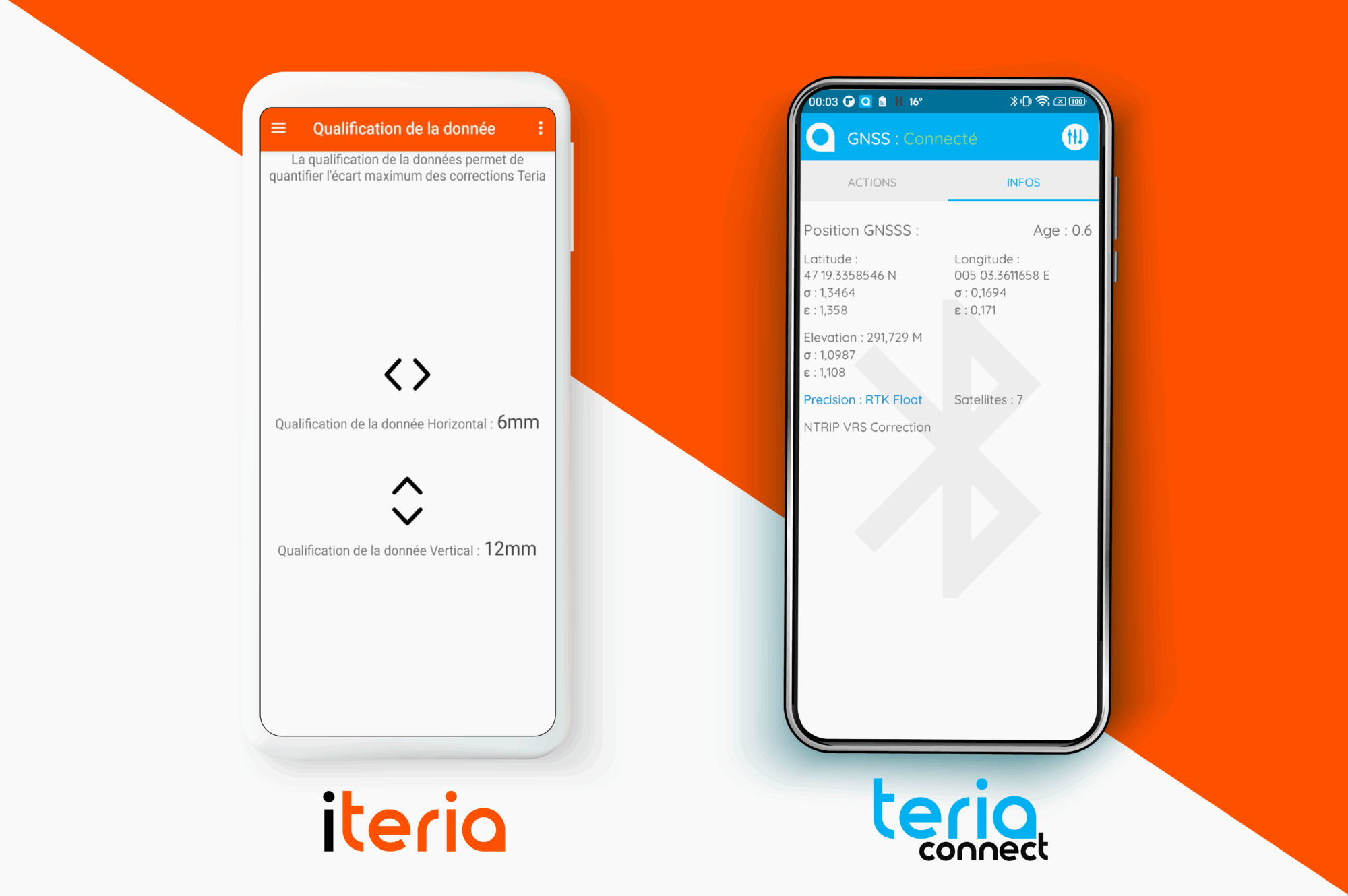
Data Qualification is an innovation developed by TERIA to guarantee the level of accuracy for its users. This functionality is free and accessible via the TERIA applications
To find out more, read this article:

Did you enjoy this article?
Feel free to share it.