
- RTK GPS: why everyone is wrong
- RTK GPS: why everyone is wrong
- RTK GPS: why everyone is wrong
- RTK GPS: why everyone is wrong
- RTK GPS: why everyone is wrong
RTK GPS: why everyone is wrong
RTK GPS: why everyone gets it wrong
(and why it doesn’t matter)
In everyday language, ‘RTK GPS’ refers to a satellite-based positioning system capable of achieving centimetre-level accuracy in real time, thanks to corrections sent to a mobile receiver. The correct term is GNSS RTK…
GPS or GNSS
what’s the difference?
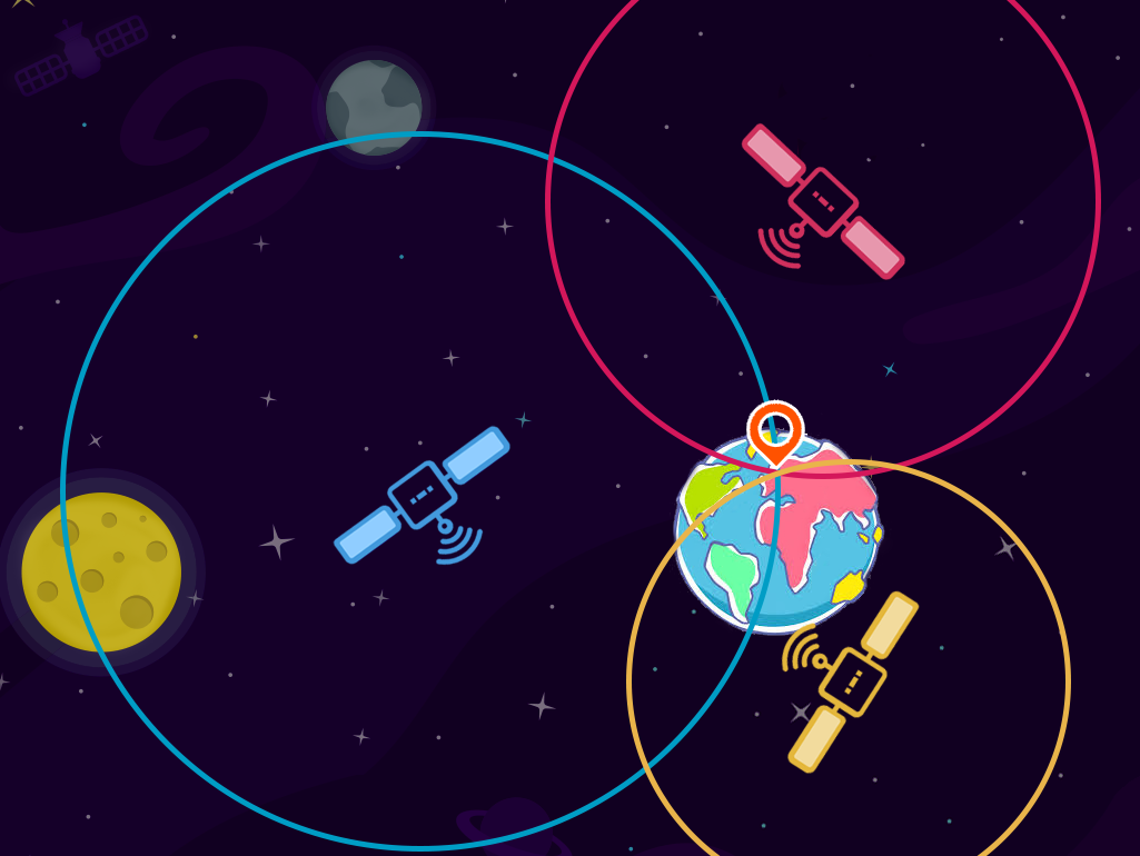
GPS (Global Positioning System) is the American positioning system, developed by the US military from 1973 onwards and made available for civilian use in 2000. It was a pioneer in this field, which is why its name has entered everyday language, much like ‘fridge’ or ‘scotch’.
But since then, other satellite constellations have joined it:
- Galileo (Europe)
- GLONASS (Russia)
- BeiDou (China)
- along with regional systems such as QZSS (Japan)
The term GNSS encompasses all of these constellations. A modern professional receiver never relies on the GPS constellation alone: it tracks 30 to 50 satellites from several constellations simultaneously. The more satellites it tracks, the better the solution model, the faster ambiguities are resolved and the more reliable the measurement, even in challenging environments (urban canyons, vegetation cover).
Saying ‘GPS’ when referring to a multi-constellation receiver is like saying ‘Airbus’ to mean aviation: an understandable shorthand, but technically incorrect.
How does RTK work?
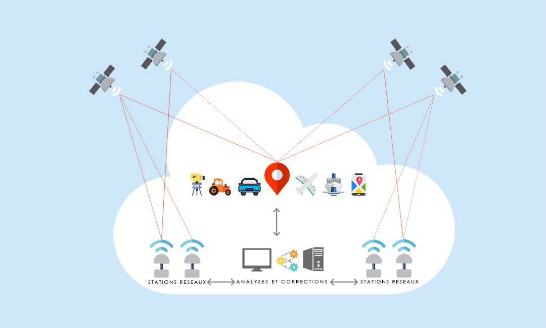
RTK (Real-Time Kinematic) is based on a simple principle: comparing the measurements taken by your receiver with those taken, at exactly the same moment, by a reference station whose position is precisely known.
- CORS reference stations
continuously monitor all GNSS signals, 24 hours a day. Their position is determined to within a millimetre. - Calculating corrections:
the difference between the station’s theoretical position and its measured position reveals current errors, ionospheric and tropospheric delays, and clock and orbital errors. - Real-time dissemination:
these corrections are transmitted to the mobile receiver (via mobile internet or a geostationary satellite), which applies them to its own observations.
Result: accuracy improves from several metres to 1–2 cm in planimetry, in real time, without post-processing.
In the case of the TERIA network, hundreds of stations are connected, forming a comprehensive network across the territory. The user no longer determines their position relative to a single reference station but relative to the entire coverage area. This is known as NRTK ( Network RTK).
To find out more about the basics: GNSS positioning – how does it work? and How do permanent GNSS stations (CORS) work?
Should we stop
saying ‘RTK GPS’?
Let’s be honest: NO. Everyday language has its reasons, and if you ask your supplier for a ‘centimetre-accurate GPS’, everyone will understand you.
But in your reports, your technical specifications and your deliverables: write GNSS.
It’s the correct term – it’s the one used by the IGN, chartered surveyors and industry standards – and it ensures your documents will stand the test of time and look professional.
At TERIA, we believe that precision starts with the right words.
That’s also why we regularly publish technical content in our Journal:
Why accuracy is no longer enough…
FAQ — GPS RTK
What exactly is RTK GPS?
This is the common name for GNSS RTK: a satellite-based positioning method that achieves an accuracy of 1 to 2 cm in real time thanks to corrections calculated by reference stations.
What is the difference between GPS and GNSS?
GPS is the US satellite constellation. GNSS refers to all satellite constellations (GPS, GLONASS, Galileo, BeiDou, etc.). All current professional receivers are multi-constellation GNSS receivers.
How accurate can RTK be?
Approximately 1 to 2 cm in planimetry and 2 to 3 cm in altimetry, under normal observation conditions.
Do you need a base station to use RTK?
No. A subscription to an NRTK network such as TERIA replaces the local reference point: corrections are calculated by the national network of permanent stations and transmitted via mobile internet or by satellite (TERIAsat).
Le RTK fonctionne-t-il partout en France ?
Le réseau TERIA couvre l’ensemble du territoire national, métropole et outre-mer et même plusieurs pays étrangers en Europe et dans monde. Consultez la page couverture réseau pour le détail.

Did you enjoy this article?
Feel free to share it.